
 01
01Land & Cadastral Surveying
Comprehensive boundary demarcation, title surveys, land regularization, and cadastral mapping for secure land ownership across Tanzania.
View details
2012
Established
22,700+
Plots Surveyed
7+
Regions
10+
Team
Land Surveying • GIS • Mapping • Geospatial
From cadastral boundary surveys and topographic mapping to drone photogrammetry and construction staking — trusted by 200+ clients across Tanzania since 2012.
We combine technical expertise, modern surveying technology, and practical field experience to deliver dependable results for every project.



Capability Statement
Cadastral surveys, boundary demarcation, and title registration. Every parcel defined with legal precision and technical accuracy.
Engineering surveys, construction set-out, and as-built documentation. The foundation for infrastructure that performs.
GIS databases, topographic mapping, and spatial analysis. Transforming field data into decision-ready intelligence.
Our Services
From cadastral boundary surveys to UAV aerial mapping, we offer a full spectrum of land surveying and geospatial services — backed by BCLS-licensed professionals and modern equipment.
01Comprehensive boundary demarcation, title surveys, land regularization, and cadastral mapping for secure land ownership across Tanzania.
 02
02Detailed terrain mapping for planning, design, and construction ΓÇö capturing all natural and built features to the required specification.
 03
03Construction set-out, deformation monitoring, as-built surveys, and precision control for infrastructure projects.
 04
04Geographic information systems, spatial analysis, and cartographic mapping solutions for land administration and resource management.
 05
05Town planning design, master plans, land use planning, and urban renewal studies for sustainable development.
 06
06High-precision coordinate control, GNSS RTK surveys, and geodetic network establishment using modern satellite positioning technology.
 07
07UAV/drone aerial mapping, environmental monitoring, and other specialised geospatial services.
About LandTech
2012
Established
No. 266
BCLS Licence
7+
Regions Served
10+
Team Members
LandTech Solutions is a Tanzanian company established in 2012, registered under the Companies Ordinance (Cap 212) with certificate of registration number 239460. The company provides consultancy and technical services in land surveying and land use planning, including topographical mapping, cadastral surveys, engineering surveying, and town and urban land use planning, supported by Geographical Information Systems (GIS).
LandTech Solutions further provides consultancy services in land and engineering surveying, natural resource management, and environmental monitoring across all sectors. To deliver these services effectively, LandTech Solutions collaborates with other land development professionals — including real estate developers, architects, town planners, environmental engineers, and civil engineers — on each assignment.
Mission
To provide our clients with high quality, affordable solutions for land management and surveying.
Vision
To be the preferred land solutions model in Tanzania and East Africa, with reach across Africa.
“We believe that the most developed region of the world is the most mapped region — the Land Surveyor being the Engineer.”
— LandTech Solutions founding principle
Registered Company
BRELA Companies Ordinance Cap 212
239460
Recognised Professional Practice
Board of Control and Licencing of Surveyors
RC0197
Licensed Surveying Practice
Director's Practising Licence
266
Professional Member
Institution of Surveyors Tanzania
293
Track Record
Featured Work
A selection of major projects delivered across Tanzania — from large-scale cadastral surveys and town planning to GIS support for national urban development strategies.
Showing 11 of 11 projects
View all 11 projectsWhether it's a cadastral survey, town planning design, or GIS mapping — we'd love to discuss how we can support your next project.
Our Team
Our team combines decades of field experience with technical expertise in land surveying, GIS, and geospatial data management.
Technology
Our investment in modern instrumentation and software ensures every project benefits from the latest advances in geospatial technology.

Accuracy: 1ΓÇô2 cm (H), 2ΓÇô3 cm (V)
Dual-frequency satellite positioning for centimetre-accurate surveys. Connected to CORS networks for real-time corrections across Tanzania.
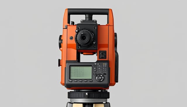
Angular Accuracy: 2″ (Leica TC1202+)
High-precision optical and robotic total stations for detailed surveys, construction set-out, and deformation monitoring.

Ground Resolution: 2ΓÇô5 cm GSD
Aerial photogrammetry and orthophoto mapping for rapid large-area surveys, volumetric analysis, and 3D modelling.

Digital Accuracy: 1 mm / km (Leica Sprinter 250M)
Precision height measurement for engineering surveys, construction set-out, and vertical control establishment.

Platforms: ArcMap GIS, QGIS, PostGIS
Geographic information systems, spatial analysis, and cartographic mapping solutions for land administration and resource management.

Core Platform: AutoCAD + Civil 3D
Professional computer-aided design and engineering software for plan production, 3D modelling, and infrastructure design.
How our technology stack works together from field to final plan
Client Feedback
“LandTech delivered precise cadastral surveys for our housing development project on schedule and to the highest standards. Their attention to detail and understanding of Tanzanian land law made the entire process seamless.”
“The topographic survey data provided by LandTech was instrumental in our highway design. Their use of modern technology, including UAV photogrammetry, gave us comprehensive terrain data that conventional methods would have taken weeks longer to capture.”
“We rely on LandTech for our monthly volumetric surveys. Their drone-based approach is fast, accurate, and the reports are always delivered on time. They understand the mining environment and deliver consistently.”
3 client testimonials • Names and organisations verified
Get Started
Tell us about your project. We'll assess your requirements and provide a clear, detailed proposal — no obligation.